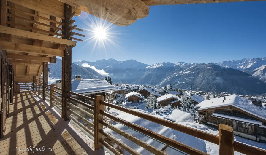
Verbier
A south-facing terrace at 1,500 m with the largest linked ski area in Switzerland below it, a serious off-piste reputation, and prices to match.
Verbier sits on a broad south-facing shelf at about 1,500 m in the Valais, above the Val de Bagnes, and it is the resort serious skiers name first.
The reason is the terrain. Verbier is the main gateway to the Four Valleys, the largest linked ski area in Switzerland — around 400 km of piste — and, more to the point, it sits under some of the most accessible steep off-piste in the Alps.
It is also expensive, international and rather pleased with itself. The village is a sprawl of chalets rather than a historic centre, and nobody comes for the architecture.
The skiing
Mont Fort, at 3,330 m, is the high point and the glacier, holding snow into spring.
The off-piste is the draw: the Backside of Mont Fort, Vallon d’Arby, the Stairway to Heaven. These are avalanche terrain, not marked runs, and they are the reason Verbier has a large population of mountain guides — hire one.
Every spring the resort hosts the final of the Freeride World Tour on the Bec des Rosses, a face so steep it looks unskiable from the village. It is free to watch from the Col des Gentianes and it is genuinely alarming.
The Four Valleys area proper runs to about 90 lifts and cable cars, linking Verbier with Nendaz, Veysonnaz, Thyon and La Tzoumaz; roughly 39% of the piste is graded blue, 44% red and 17% black. The Mont Fort cable car itself opens up views to the Matterhorn, the Grand Combin and Mont Blanc, with a black run off the front of the summit and further off-piste continuing down toward Siviez. Mont Gelé, reached by a separate cable car from Les Attelas at around 3,020 m, has steeper ground again. Two of the classic off-piste lines give a sense of the scale involved: about 900 m of vertical from the Col des Gentianes down to Tortin, and roughly 1,000 m from the Vallon d’Arby down to La Tzoumaz at the edge of the ski area.
Parts of the terrain hold snow all year, which is one reason a number of professional and former professional skiers base themselves in Verbier rather than just visiting. Resort life centres on the Place Centrale and the Médran lift station a few hundred metres from it, with buses running between the scattered chalets and hotels.
Verbier is also a start and staging point for the Haute Route, the multi-day ski tour on to Zermatt or Saas-Fee — a guided, touring-kit undertaking rather than a day’s off-piste. For comparable terrain elsewhere in Switzerland, Andermatt’s Gemsstock draws the same crowd, with its own serious runs and difficult freeride lines.
Summer
Quieter and much cheaper, and the terrain that makes it good for skiing makes it good for the rest.
Verbier is one of the main mountain biking centres in Switzerland, with lift-served descents and the Verbier E-Bike Festival. There are around 400 km of marked walking paths, and the Tour des Combins and the Haute Route to Zermatt or Chamonix both pass nearby.
The mountain-bike network runs to around 200 km of marked trail in total, and some of the walking routes follow old chamois trails, staying snow-covered well into summer. Among the marked hikes: the Sentier des Chamois above Verbier, around six hours; a circuit of the lakes above Lourtier, with a shorter three-hour option and a longer seven-and-a-half-hour version; the climb to Pierre Avoi, reachable from La Tzoumaz, Verbier or Vollèges in ninety minutes to four hours depending on the starting point; and the path to the Lac des Vaux from La Tzoumaz, around five hours.
There is also paragliding over the valley and scope for more serious mountaineering on the surrounding peaks. The Mont Fort cable car keeps running in summer too, for the view alone — Matterhorn to Mont Blanc, with no walking required.
The Verbier Festival in late July and early August is a serious classical music event, with an orchestra of young musicians and a fair share of the world’s best soloists teaching and performing in a tent on the mountainside.
Around Verbier
Martigny, the valley town on the way in from Geneva, carries Celtic, Roman and Napoleonic traces, and a handful of archaeological finds around the town give some sense of how the original settlement began. Above it, a short walk through tunnels, up stairways and along galleries follows the Durnand gorge as the river forces its way between the rock walls — the noise of it carries the whole route.
South of Martigny, the Grand Saint Bernard Pass sits at about 2,470 m; a road of some 70 km over the pass connects Martigny with Aosta in Italy.
Several spa towns are within reach by road for anyone who wants thermal baths rather than more mountain: Saillon, Lavey, Ovronnaz, Val-d’Illiez and Loèche-les-Bains.
Getting there
- By train and bus — the railway reaches Le Châble in the valley below (Geneva about two and a half hours, Zurich about four), then a cable car or a bus climbs to the resort in ten minutes.
- By air — Geneva is the airport, about two hours by road.
- The cable car from Le Châble runs year-round and means a car is unnecessary.
- Verbier has no fast rail link of its own: every route runs via Martigny, changing onto the small regional line to Le Châble before the final cable car up — one change from Geneva, several from Zurich or Basel, where a Swiss Transfer Ticket is worth checking against ordinary fares.
- In the ski season, buses also run from Sion, and direct coaches reach Martigny from Geneva Airport, Basel, Milan and the Chamonix-Mont-Blanc resort.
Practical
- Expensive, particularly in February and at Christmas. January and late March are the value weeks.
- The lift pass covers the Four Valleys and is priced accordingly; a Verbier-only pass is cheaper if you will not range that far.
- Off-piste — check the avalanche bulletin, carry a transceiver, and take a guide. People die here every winter, and almost always outside the marked runs.
When to go
December to April for skiing, with the best snow usually February and March. July and August for walking, biking and the festival.
May, June, October and November are the closed months — most of the resort shuts.
Where to park in Verbier
| Car park | Spaces | Fee | From centre |
|---|---|---|---|
| Ermitage | — | paid | 100 m |
| Marais Verts underground | — | — | 100 m |
| Parking du Catogne | — | paid | 540 m |
| Périn | — | paid | 870 m |
| Les Esserts | — | — | 1.3 km |
Data © OpenStreetMap contributors, ODbL licence, snapshot of 22 August 2026. The map is drawn by volunteers: the list is not complete, and a dash means “not recorded” — not “free” and not “no spaces”. This is not an official parking directory: when you get there, read the signs and the machine at the entrance.
Weather in Verbier month by month
| Month | Day | Night | Rainfall |
|---|---|---|---|
| January | 0° | -9° | 59 mm |
| February | 0° | -9° | 49 mm |
| March | +3° | -6° | 57 mm |
| April | +7° | -1° | 71 mm |
| May | +13° | +4° | 101 mm |
| June | +17° | +8° | 94 mm |
| July | +19° | +10° | 91 mm |
| August | +19° | +10° | 90 mm |
| September | +16° | +6° | 77 mm |
| October | +11° | +3° | 78 mm |
| November | +5° | -3° | 86 mm |
| December | +1° | -8° | 66 mm |
Averages for 1991–2020, computed from NASA POWER daily data and corrected for the elevation of the place (1494 m). Day and night are the average daily high and low, not records; rainfall is approximate. Current conditions from the Norwegian Meteorological Institute, CC BY 4.0.
Updated: