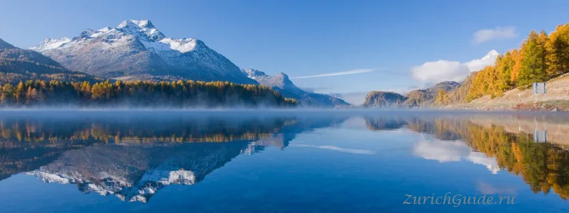
St. Moritz
A high Engadin lake, 322 days of sun a year by its own count, and the hotelier's bet in 1864 that started winter tourism.
St. Moritz sits at 1,822 m in the Engadin, a high valley in Graubünden that runs south-west to north-east and gets an unusual amount of sun — the resort claims 322 days a year, and while nobody has audited it, the light up here is genuinely different.
It is where the winter holiday was invented. In September 1864 the hotelier Johannes Badrutt bet four English summer guests that they would enjoy the place in winter, and offered to pay their travel if not. They came at Christmas, stayed until Easter, and told everyone. Winter tourism dates from that bet.
The town has hosted two Winter Olympics, several world championships, and more than a century of people who wanted to be seen. It remains expensive and slightly unreal.
The town
St. Moritz itself is not much to look at: a string of grand hotels and expensive boutiques climbing the hillside above the lake. Jewellers, watchmakers, couture houses and chocolate shops are stacked densely enough that the selection is occasionally likened to Zurich’s Bahnhofstrasse, and the sales here start later in the season than elsewhere in the country. Anyone without a budget to match generally stays instead around the lake, in St. Moritz Bad. Besides the skiing, the resort also functions as a health spa.
The lake and the valley
The lake freezes solid in winter and the town puts things on it: horse racing on the ice, polo, cricket, and a golf tournament. In summer it is sailing and windsurfing, with a marked path all the way round in about an hour.
Beyond it the Upper Engadin lakes — Champfèr, Silvaplana, Sils — run south-west in a chain, with Silvaplana the windsurfing centre because the Maloja wind arrives every afternoon with reliability you can set a watch by.
Sils Maria, at the far end, is where Nietzsche spent seven summers and wrote most of Zarathustra. His house is a small museum, and the walk out to the Chastè peninsula is the one he took daily.
The mountains
Corviglia, straight up from the town by funicular, is the main ski area and gives the classic view down the lakes.
Diavolezza, at 2,978 m, is the one to do in summer: the cable car ends opposite the Bernina massif with the Pers and Morteratsch glaciers below, and in winter there is a guided glacier descent from the top.
Muottas Muragl, reached by a 1907 funicular, has the best view in the valley for the least effort — the whole chain of lakes laid out below — and a panorama path along the ridge.
Walking is a large part of why people come here at all, in summer as much as winter, and the valley is threaded with marked trails through the mountains above the lakes. In winter, toboggan runs in the hills around the resort draw almost as much traffic as the ski slopes.
The Engadin houses
Worth knowing what you are looking at. The traditional houses here are thick-walled, with deep funnel-shaped window recesses and sgraffito decoration — patterns scratched through white lime plaster to the darker layer beneath. The villages of Guarda, Ardez and Zuoz have the best of it, and Zuoz is twenty minutes away by train.
Art
The Segantini Museum holds the work of Giovanni Segantini, who painted these mountains in the 1890s and died at 41 on the Schafberg above Pontresina while finishing his alpine triptych. The museum was built for that triptych and it is worth the visit even if the name means nothing to you.
Engadiner Museum
A second, smaller museum is arranged as a set of period rooms and covers domestic life in the valley rather than art: traditional interiors, furniture, stoves, and some archaeological finds from the Engadin’s earlier history.
Getting there
- By train — Zurich about three and a half hours via Chur; the last stretch is the Albula line, which is UNESCO-listed and the best part of the Glacier Express route.
- Bernina Express — St. Moritz is the northern end, with Tirano in Italy four hours south.
- No airport, no motorway. Getting here is deliberately slow and the journey is half the reason to come.
- The Albula line itself is part of the appeal, not just a way to reach the panoramic final stretch: from Chur it climbs through steep gorges on a run of old stone arch bridges.
There is no direct rail link from the airport: arriving by air means changing at Zurich and again at Chur, and the whole run takes close to four hours. After a late landing the last trains may already have gone, and the alternative is a private transfer by car, which runs to the order of a thousand francs one way; check current rates.
Arriving by train
St. Moritz is usually the terminus, arriving on platform one; the lake is on the other side of the station, reached through an underpass, with escalators up to the town centre and a large underground car park. Buses meet the trains for the hotels, and yellow PostBus services leave from the station square for Silvaplana, Sils Maria and Maloja, where a connecting bus continues down through the Lower Engadin towards Italy, as far as Castasegna.
Anyone spending several days in the region and relying on public transport should look at Graubünden’s own regional travel pass, which covers unlimited travel on trains and PostBus routes across some or all of the canton, plus discounts on several mountain railways; see tickets and passes and saving money.
When to go
Mid-December to March for the winter season and the events on the frozen lake. July to September for walking, when the valley is green, the lakes are warm enough to swim in and the prices are a fraction of the winter ones.
Late June and November are the shoulder months when much of the town closes.
Where to park in St. Moritz
| Car park | Spaces | Fee | From centre |
|---|---|---|---|
| Quadrellas underground | — | paid | 100 m |
| Gallaria multi-storey | — | paid | 270 m |
| Serletta underground | — | paid | 280 m |
| Bootshaus | 20 | paidmax 4 h | 350 m |
| RhB St. Moritz Kurzzeit | — | paidmax 12 h | 510 m |
| P+R RhB St. Moritz | — | paid | 660 m |
| Punt da Piz | — | paidmax 10 h | 700 m |
| St. Moritz See | 33 | paidmax 10 h | 1.0 km |
3 more are mapped nearby — see them on OpenStreetMap.
Data © OpenStreetMap contributors, ODbL licence, snapshot of 22 August 2026. The map is drawn by volunteers: the list is not complete, and a dash means “not recorded” — not “free” and not “no spaces”. This is not an official parking directory: when you get there, read the signs and the machine at the entrance.
Weather in St. Moritz month by month
| Month | Day | Night | Rainfall |
|---|---|---|---|
| January | -2° | -17° | 29 mm |
| February | 0° | -16° | 19 mm |
| March | +3° | -10° | 24 mm |
| April | +7° | -5° | 37 mm |
| May | +12° | -1° | 67 mm |
| June | +16° | +2° | 91 mm |
| July | +19° | +4° | 87 mm |
| August | +18° | +4° | 100 mm |
| September | +14° | +1° | 73 mm |
| October | +10° | -3° | 77 mm |
| November | +3° | -9° | 70 mm |
| December | -2° | -14° | 37 mm |
Normals for 1991–2020 from MeteoSwiss, station Samedan, open data, version of 29 July 2026. Adjusted to the elevation of the place. Day and night are the average daily high and low, not records; rainfall is approximate. Current conditions from the Norwegian Meteorological Institute, CC BY 4.0.
Updated: